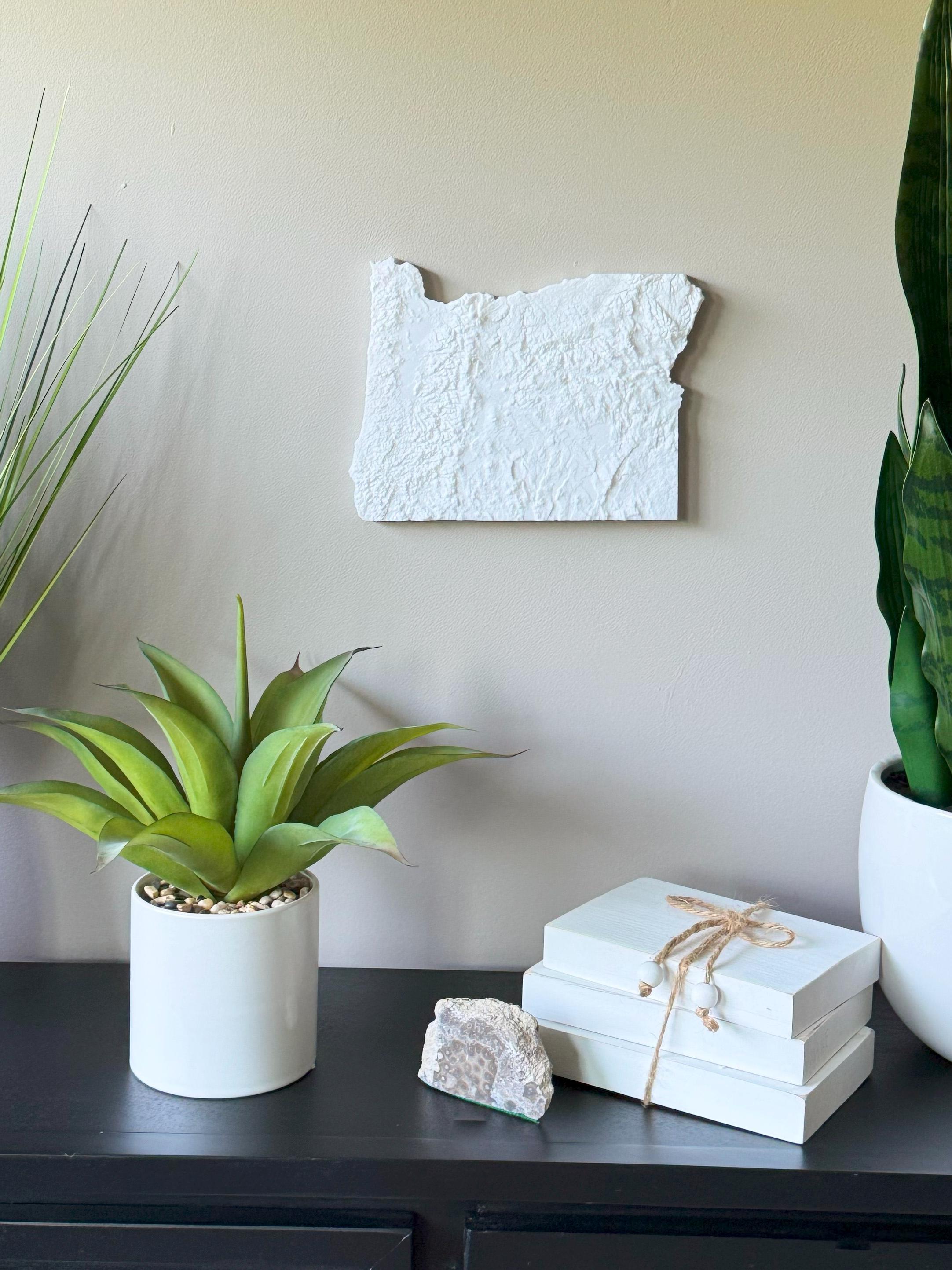
Bring Oregon’s stunning natural beauty to your walls with this 3D Topographical Map of Oregon, carefully 3D printed with sustainable PLA filament. From the Cascade Range and Mount Hood to the deep gorges, high deserts, and Pacific coastline, this map captures Oregon’s diverse geography in dynamic 3D detail.
Designed from real elevation data, this map is both a beautiful art piece and a tribute to the state’s adventurous spirit. Whether you're from Portland, Bend, Eugene, or love the Columbia River Gorge, this piece adds rugged elegance to your space.
Product Highlights:
• Designed from real topographic elevation models
• Printed with eco-conscious, plant-based PLA filament
• Lightweight and easy to hang with the built-in hanger
• Framed dimensions: 10.5" x 10.5" x approx. 0.5" deep
• Unframed dimensions: 7.25" height x 9.8" width x approx 1-1.5" deep
• Handmade in the USA
Perfect For:
• Oregon locals and Pacific Northwest fans
• Coastline adventurers, hikers, and skiers
• Cabin, cottage, or modern home decor
• Graduation, wedding, or nature-lover gifts
• Teachers, travelers, and collectors
Customization Available:
Message us for customizations!
Sustainably Made:
Crafted with PLA filament from renewable plant resources.
Whether it’s the forest, coast, or mountains, this 3D-printed Oregon topographical map captures the untamed beauty of the Pacific Northwest.